Active geological processes often generate a ground surface response such as uplift, subsidence and faulting/fracturing. Nowadays remote sensing represents a key tool for the evaluation and monitoring of natural hazards. The use of unmanned aerial vehicles (UAVs) in relation to observations of natural hazards encompasses three main stages: pre- and post-event data acquisition, monitoring, and risk assessment.
The mud volcano of Santa Barbara (Municipality of Caltanissetta, Italy) represents a dangerous site because on 11 August 2008 a paroxysmal event caused serious damage to infrastructures within a range of about 2 km. The main precursors to mud volcano paroxysmal events are uplift and the development of structural features with dimensions ranging from centimeters to decimeters. Here we present a methodology for monitoring deformation processes that may be precursory to paroxysmal events at the Santa Barbara mud volcano.
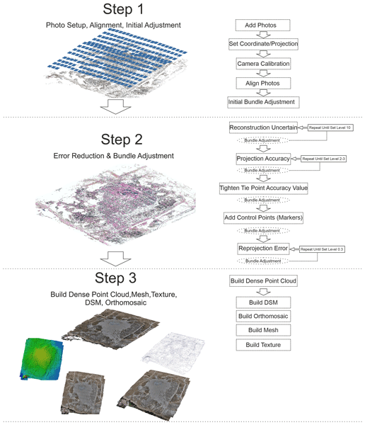
This methodology is based on (i) the data collection, (ii) the structure from motion (SfM) processing chain and (iii) the M3C2-PM algorithm for the comparison between point clouds and uncertainty analysis with a statistical approach. The objective of this methodology is to detect precursory activity by monitoring deformation processes with centimeter-scale precision and a temporal frequency of 1–2 months.