ABSTRACT
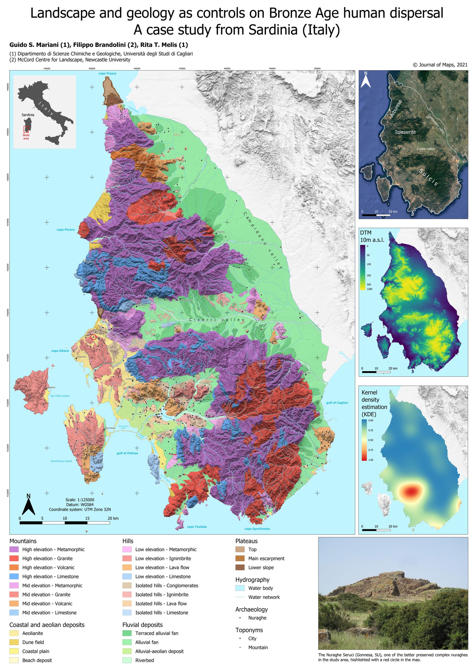
The interaction of human dispersal patterns with landscape features can in many cases provide useful information on the sustenance strategies of past communities. Mapping the present landscape is a necessary step in recognizing the nature, impact, and diffusion of the processes which drive the behaviour of past populations and modify palaeolandscapes. We constructed a map of the land units in the southwestern corner of Sardinia and compared them with the distribution of known Bronze Age megalithic towers called nuraghes. The vast majority of nuraghes are near the plains or at mid elevations close to the river network, in areas with the highest landscape diversity. The occurrence of nuraghes also seems to be related to elevated outcrops giving the advantage of a raised position and stable foundations. Denudation processes, Late Holocene sea level rise, and anthropogenic disturbance seem to be the most important factors driving changes in the palaeolandscape.
Carta: https://www.tandfonline.com/doi/suppl/10.1080/17445647.2021.1999339?scroll=top
DOI: https://doi.org/10.1080/17445647.2021.1999339
Autori: Guido S. Mariani, Filippo Brandolini & Rita T. Melis
This is an Open Access article distributed under the terms of the Creative Commons Attribution License (http://creativecommons.org/licenses/by/4.0/), which permits unrestricted use, distribution, and reproduction in any medium, provided the original work is properly cited.